Historic Blizzard Pummels Ontario: 100+ cm of Snow, Road Closures, and Travel Chaos!
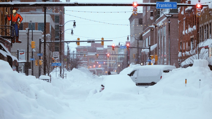
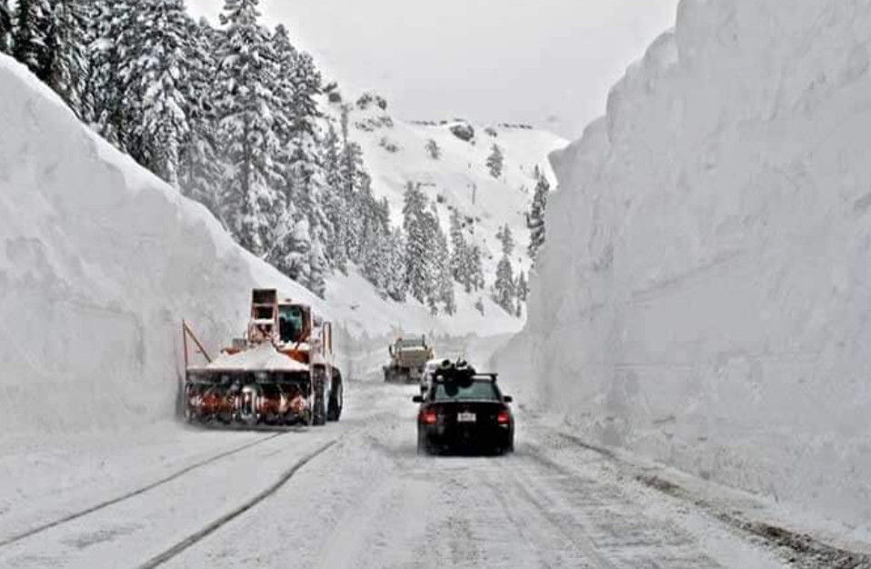
Southern Ontario is experiencing its first major winter storm of the season, and it's hitting hard. A sprawling low-pressure system, coupled with lake-effect enhancement, has dumped record-breaking snowfall across the province, leaving communities buried under meters of snow and grappling with widespread disruptions.
Unprecedented Snowfall Totals
The snowfall totals are staggering. Gravenhurst in Muskoka region has received a staggering 140 centimeters of snow, while Echo Bay saw 136 cm. Bracebridge reported 125 cm, and Sault Ste. Marie 105 cm. These numbers are not only unprecedented for this early in the season but also represent substantial increases compared to typical yearly snowfall amounts. Other areas throughout Southern Ontario experienced notable snowfall accumulations, with reports ranging from 57 cm (London) to over 60 cm in various towns and cities, making travel extraordinarily difficult.
Lake Effect Snow Squalls Intensify the Storm
The intense snowfall is being amplified by lake-effect snow squalls, which are narrow bands of heavy snow generated when cold air sweeps across relatively warmer lake waters. These snow squalls are responsible for dramatically varying snowfall amounts over short distances—the difference from clear skies to blizzard conditions could be a mere few kilometers. This phenomenon, coupled with strong winds exceeding 70 km/h, has created near-whiteout conditions and extremely hazardous travel conditions, leading to road closures and numerous accidents.
Widespread Disruptions and Emergency Measures
The storm's impact has been far-reaching. Numerous highways have been temporarily closed, resulting in stranded vehicles and significant travel delays. Emergency services have reported widespread disruptions, with hundreds of vehicles stranded on roadways. In Gravenhurst, a state of emergency was declared over the weekend to facilitate emergency response and resource allocation, while the OPP, and other emergency responders, worked tirelessly to rescue stranded motorists and clear obstructions. In some areas, power outages have been reported due to the heavy, wet nature of the snow. The wet snow, coupled with strong winds, increases the chance of localized power outages and tree damage due to the increased weight of the accumulation.
Travel Advisory and Safety Precautions
Authorities are urging residents to avoid all non-essential travel until conditions improve. For those who must travel, it's imperative to carry an emergency kit containing essentials like drinking water, food, medicine, a first-aid kit, and a mobile phone. Public Safety Canada strongly recommends making an emergency plan and informing others of your travel plans, destinations, and estimated travel times. The Ontario Provincial Police are advising drivers to adjust travel plans, allow plenty of extra travel time, increase following distances, and maintain extra caution in adverse conditions.
The Storm's Impact on Various Regions
The storm's impact is not uniform across Ontario. While some areas have been hit harder than others, the entire province is feeling the effects. The GTA is expecting a significant accumulation of snowfall over the next few days, ranging from a few centimeters in urban areas to substantially more in neighboring regions.
GTA and Surrounding Areas
The Greater Toronto Area is expected to experience snowfall starting Wednesday morning, with accumulations of roughly 5-10 centimeters, but this may vary greatly due to the unpredictability of the lake-effect bands, resulting in some locations receiving higher accumulations compared to others. The city is taking preventative measures, including preemptively salting roads and bridges to prevent black ice formation. The weather advisory emphasizes that motorists should anticipate hazardous winter driving conditions and adjust their travel plans accordingly.
Niagara Region and Eastern Ontario
The Niagara region and eastern Ontario are under a snow squall watch, potentially facing accumulations near 20 centimeters. Highway 401, a major transportation artery, could be significantly impacted by lake effect snow squalls. Peak snowfall rates of two to five centimeters per hour are predicted, leading to rapidly deteriorating road conditions.
Northern Ontario
Northern Ontario also is experiencing substantial snowfall. Areas east of Lake Superior, particularly around Wawa and Sault Ste. Marie, have been heavily impacted, with forecast snowfall accumulations of 30 to 50 centimeters. The area around Georgian Bay and Sudbury could see around 20 centimeters.
Looking Ahead: Continued Challenges and Recovery
While the heaviest snowfall is expected to subside, the storm's aftermath will continue to impact the province for days to come. Cleanup efforts will be extensive, requiring considerable time and resources. The potential for further snowfall and the ongoing risk of lake-effect snow squalls highlight the need for continued vigilance and caution. Many regions are already preparing for a challenging commute and are urging residents to stay updated on weather alerts and advisories issued by Environment Canada.
A Long Road to Recovery
The recovery phase will be long and arduous. With the scale of the snowfall and the potential for continued snow squalls and heavy snowfall, communities will require significant support and resources. This historic winter storm serves as a reminder of the power of nature and the importance of preparedness. Remember to check on vulnerable neighbours and those who may be struggling with the recovery effort. Please continue to monitor alerts and forecasts issued by Environment Canada. Remember to adjust driving habits to conditions and always allow extra travel time.
Please stay safe and warm.


