Ireland's Weather Rollercoaster: A Near Miss and a Week of Unsettled Conditions
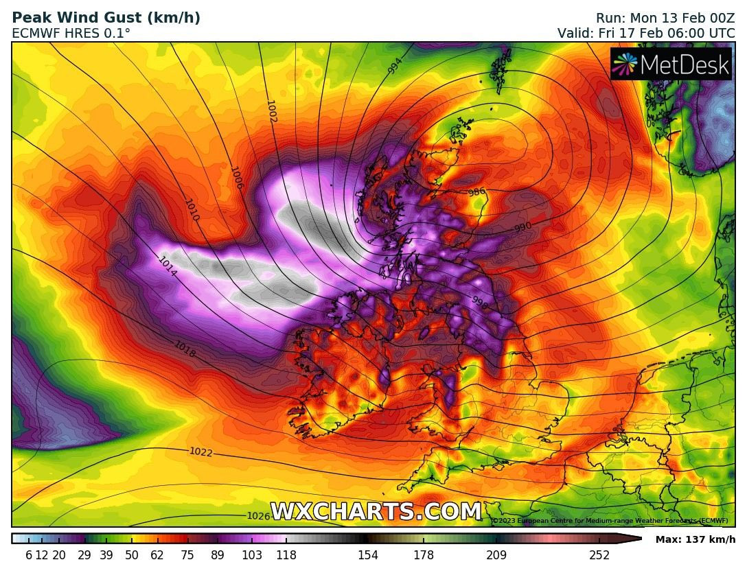
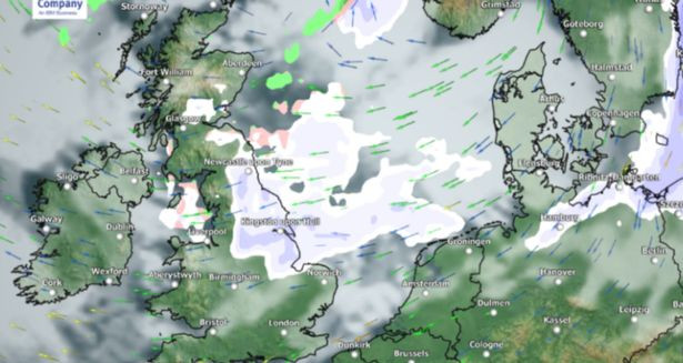
Ireland has had a close call with another potential “Beast from the East,” a major winter storm that could have brought heavy snowfall. However, according to Carlow Weather's Alan O’Reilly, “the real cold stays away from Ireland.” While a significant amount of snow is expected in western Scotland and some areas of Ulster, Ireland will largely be spared the worst of the wintry conditions, though not entirely. The current forecast from Met Éireann paints a picture of a week dominated by a complex interplay of air masses, resulting in heavy rain, strong winds, and generally unsettled weather.
Current Weather Conditions and Short-Term Forecast
The current weather pattern is characterized by the battle between two air masses: a cold, but not freezing, rain-laden system and a much colder one with the potential for ice and snow. Thankfully for Ireland, the milder, wetter air mass appears to have won, but this does not translate to pleasant weather. Today will see outbreaks of rain and drizzle, mainly affecting Connacht and Munster, with higher temperatures of 5 to 8 degrees. Tonight, the rain and drizzle will continue in the west and southwest, and extend further east. Temperatures will dip to between 1 and 4 degrees, less cold in the southwest.
Wednesday night's forecast is similar to tonight’s, with rain and drizzle, especially in the west and southwest, and the Potential for sleet on higher ground. Temperatures will remain between 2 and 5 degrees. Thursday will bring cold and breezy conditions with scattered showers, mainly in the west and southwest, though heavier rain will move in from the southwest to Munster, Connacht, and parts of south Leinster in the afternoon and evening. Temperatures will reach 4 to 7 degrees, dropping to 2 to 5 degrees overnight.
Friday will start with scattered rain and drizzle, easing into the afternoon, especially in the east. Temperatures will range from 5 to 8 degrees. The weekend forecast remains uncertain, with the potential for rain and drizzle, especially in the southwest and west. However, the east might see drier conditions. Temperatures will range from 5 to 9 degrees, and 1 to 5 degrees overnight.
Long-Range Forecast and Potential Impacts
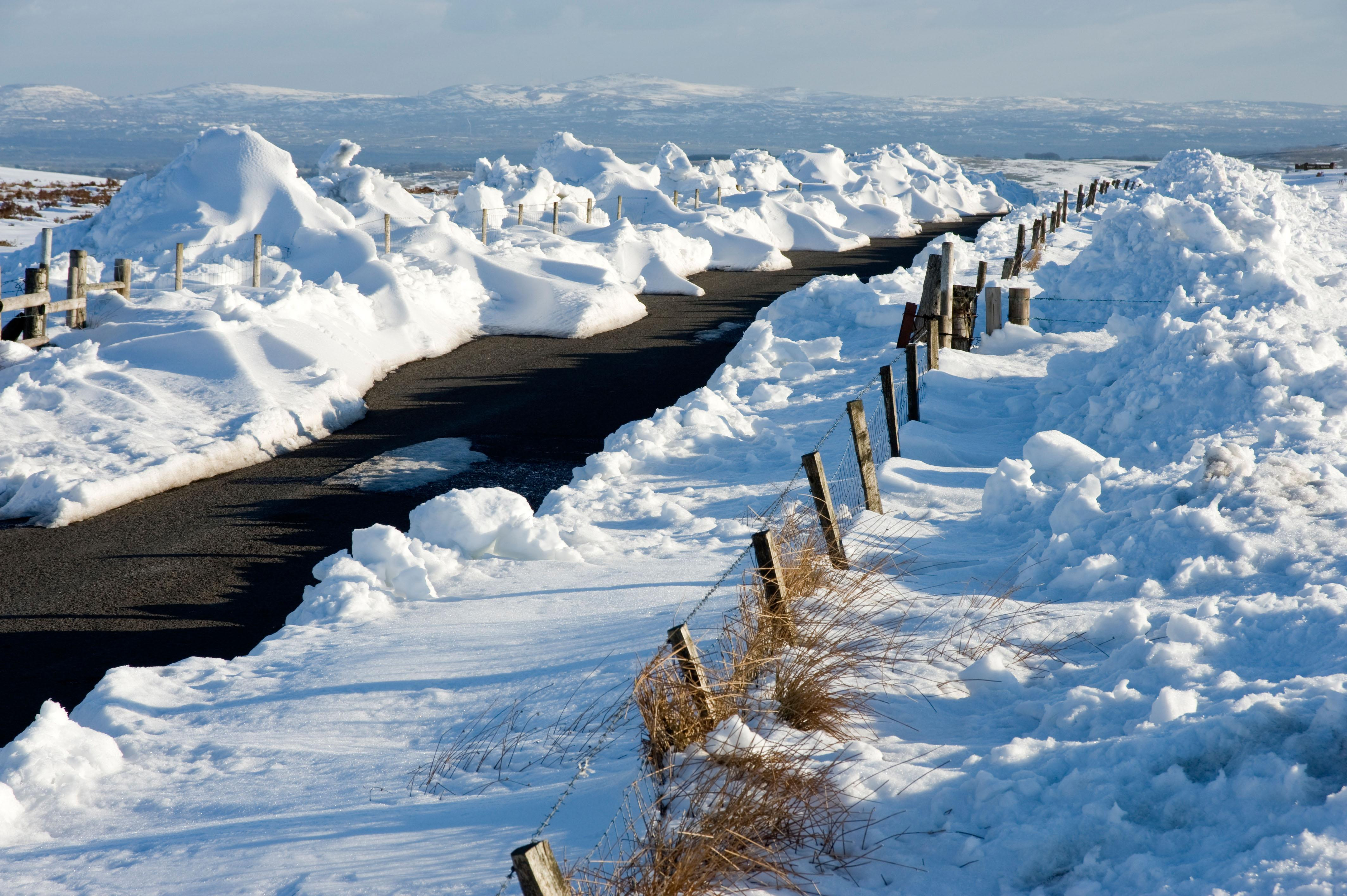
The unsettled weather pattern is expected to continue well into next week, Met Éireann’s long-range forecast suggests. The national forecaster said that multiple low-pressure systems moving across the Atlantic will bring frequent spells of rain and gusty winds to most parts of the country. Near gale-force winds are anticipated along western and southern coasts, and heavy rainfall could lead to difficult driving conditions and potential localized flooding. This relentless pattern of rain and wind will make it feel significantly colder than the actual temperatures suggest. Temperatures will hover around average, but the persistent dampness will exacerbate the chill. This is shaping up to be a long period of consistently wet conditions in many parts of Ireland.
A Deep Dive into the Meteorological Models and Expert Analysis
The meteorological models, in this case GFS and ECMWF, show differences in their predictions. James Peacock, a leading atmospheric science communicator and head meteorologist at MetSwift, highlighted the contrasting predictions. He points out how the more recent forecast from GFS still shows a high-pressure system over Scandinavia around February 21st, which could lead to another close call with very cold air for the UK. However, the current situation indicates that Ireland is likely to experience more persistent wet conditions rather than a sharp cold snap.
This reinforces the uncertainty inherent in long-range forecasting. The fact that even the GFS model, known for showing less disruption of Atlantic weather systems, predicts a high-pressure system over Scandinavia further underscores the challenges of definitively forecasting weather patterns more than a week in advance. While Ireland avoided a direct hit from a severe cold snap this time, the potential for similar weather patterns in the future highlights the importance of staying informed and prepared for weather events, even with the unpredictable nature of long-range forecasts.
The Atlantic’s Influence and Ireland's Position
Ireland's location places it between two competing air masses: milder air from a low-pressure system off North America and a cold, dry air mass over Scandinavia. This results in frequent weather fronts crossing the country, bringing rain, gusty winds, and persistent cloud cover. The Atlantic system seems set to retain control for the coming week or so, with persistent cloud cover, mist, and intermittent outbreaks of rain expected to dominate the weather landscape. The prevailing southerly winds will fuel this supply of Atlantic moisture and sustain the unsettled weather conditions.
Looking Ahead: A Week of Wetness and Wind
The extended forecast for Ireland paints a picture of a prolonged period of unsettled weather. The current forecast shows no immediate respite from the damp and windy conditions. The persistent rain, coupled with the gusty winds particularly along Ireland’s coasts, will make conditions challenging for many. The weather will continue to make for difficult driving conditions and the potential for localized flooding should not be underestimated. Stay updated with the latest forecasts from Met Éireann and take necessary precautions to ensure your safety and well-being during this period of consistently poor weather.
This extended period of rain, strong winds, and generally unsettled weather will likely impact various aspects of daily life in Ireland, impacting transport, outdoor activities, and possibly leading to localized disruptions and potential for flooding. It is crucial to remain vigilant and informed of the evolving weather pattern.
The coming days are expected to bring a continuation of heavy rain and gusty winds. The uncertainty in the long-range forecast remains a factor in planning, but it is evident that this week and next will be dominated by unsettled and often stormy weather across the country. Stay safe and informed.