A First Warn Weather Day was in place today for the level 3/5 threat for severe weather. A cold front will drop through the area late this afternoon and through midnight, triggering the chance for rain, storms and severe weather.
A Tornado Watch has been issued until 10 p.m. This does include eastern Kansas and western Missouri, including the KC metro. A line of storms will develop over the next few hours, and we are going to be watching for embedded spin-up tornadoes on that line.
We will likely have rain and storms occur from 2 - 11 tonight with the most severe storm activity moving through as a line between 7 - 11 p.m. However, there will be the chance for some widely scattered showers and non-severe rumbles before 2 p.m.
These non-severe showers and rumbles if they continue to occur could start to work over the atmosphere which in turn could impact the severe weather threat this evening along the line.
While we are no longer under a Wind Advisory, breezy to windy conditions remain until later this afternoon. However, it will be hard to shake some gusts of 30 to 35 mph. The cloud cover and rain showers will work to keep us cooler than we have been over the last few days. We will only gradually climb to the mid-70s by this afternoon.
As we move towards around 2 p,m. it’s likely we’ll see scattered or isolated showers and a few thunderstorms. During this time there may be one or two severe weather storms randomly populating through the region ahead of the front.
This will continue on and off until we move to the early evening between 5 - 7 p.m. when the front is introduced from the west. This second round between 7 - midnight is the main event. We anticipate a line of strong storms to develop along the front, with a high potential for severe storms. All modes of severe weather will be possible with any severe storm that gets going. Damaging straight-line winds will be the primary threat, wind gusts are possible between 60 - 80 mph within these storms as they become severe. A few spin-up tornadoes will also be possible and could be embedded within the line of storms. Small hail is also a hazard.
As we move into the evening, it is important you have a plan in place for this severe thunderstorm activity. In the event we break into programming for severe storm coverage this evening, Survivor and The Summit will be simulcasted on KSMO.
The storms move quickly through the region, and we anticipate them exiting the metro between midnight - 2 a.m. Thursday morning.
This will lead to a quiet but chilly Halloween. The trick-or-treating forecast from 5 - 9 p.m. will gradually drop from the mid-50s to the upper 40s, with winds not a factor at less than 5 mph.
As we move into the weekend, several new storm systems develop providing extended rain and storm activity. We’re seeing more confidence in thunderstorms developing overall, but still, not enough information to provide details on a severe weather threat. What we do see is consistent rainfall between 3 - 5 inches, conservatively. This is going to be a lot of water in a short amount of time which may lead to flooding concerns due to such dry conditions over the past several weeks.
Showers and thunderstorms swept through the Kansas City area Thursday night, producing a spectacular lightning display and drenching the metro with one of the heaviest rainfalls of the year.
Kansas City’s Northland saw the heaviest rains, with 1.73 inches falling along Missouri 152 highway at Upper Shoal Creek, according to rainfall data StormWatch.com, a collection of rain gauges across the Kansas City metro.
Areas in Johnson County and south of the Missouri River saw considerably less rainfall.
Officially, 1.27 inches of rain fell in Kansas City on Thursday, according to climate data.
“It was the wettest day since 6/26 (June 26) when we had 1.70 inches,” the weather service said. Thursday “was also the 7th wettest day of 2024 . . . the wettest being 4/18 (April 18) when we received 1.79 inches.”
The cold front that brought the overnight storms has moved out of the area, according to the weather service, bringing temperatures to near normal for late October.
“A fine, fantastic, fall weekend awaits us!” the weather service said. Dry, quiet weather and sunny skies are expected.
The weather service said Friday’s temperatures will be in the lower 60s to near 70 and Saturday’s in the upper 50s to mid-60s. Sunday will be warmer, with temperatures climbing into the 70s.
Typically, Kansas City sees temperatures around 63 degrees this time of year.
The unusually warm weather continues into next week, with temperatures climbing into the 80s on Monday and Tuesday.
Kansas City’s next best chance for rain is Wednesday night when there is a 40% to 50% chance of storms across the area.
“As of right now, no severe weather is expected due to a lack of instability,” the weather service said in its forecast discussion.
However, if the environment sees more instability, there is a potential for a “significant severe weather event.”
“If storms are able to develop, damaging winds will likely be the main hazard,” the weather service said. “We will continue to monitor the trends of these conditions with future (forecast) model runs.”
The weather service said to expect another cooling trend for the start of next weekend.
Kansas City Storm Damage Reports
Nodaway County
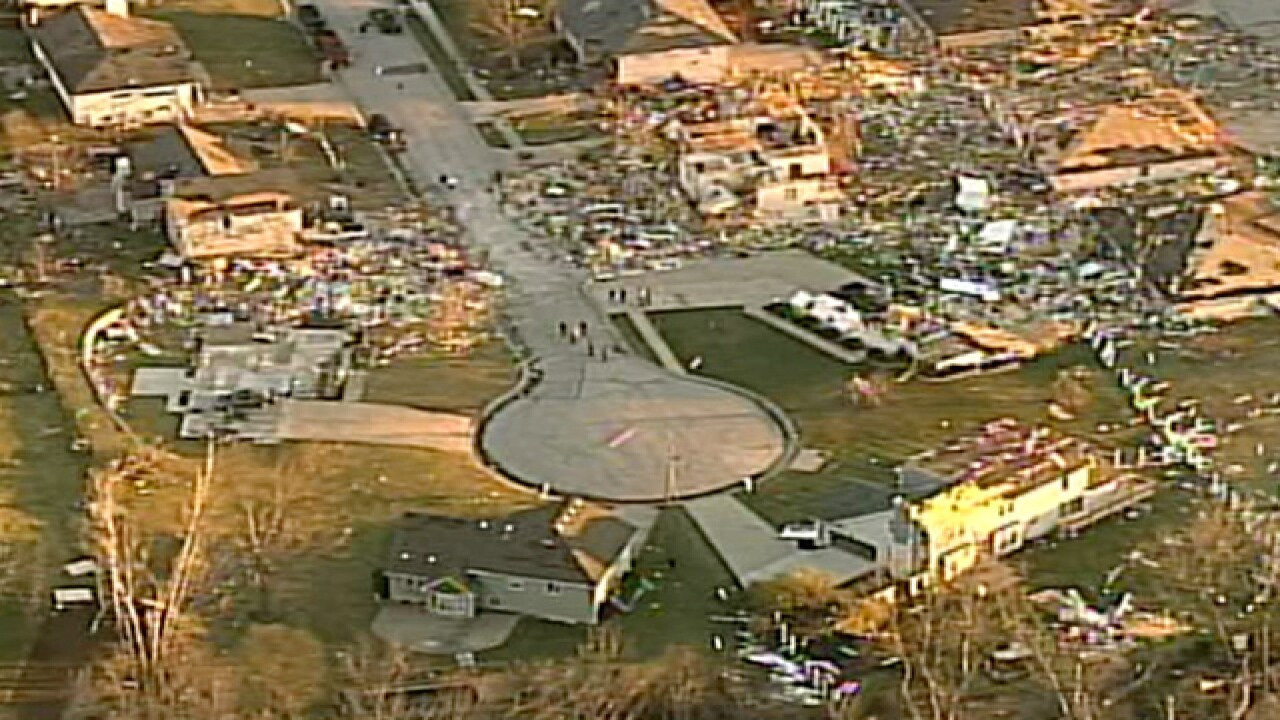
Numerous reports of damage, particularly in the western part of the county. Power poles were downed, grain bins were overturned, an implement shed and garage were destroyed, and trees were toppled. In the north and central areas, damage included a roof blown off a large shed, partial roof removal from a home, structural damage to buildings, and an overturned camper. No injuries have been reported.
Quitman, Nodaway County
Multiple power poles down near Route 46 and Route 113.
Craig, Holt County
A semi-truck overturned on I-29, downed power lines, and widespread power outages reported.
Pickering, Nodaway County
Power lines downed, causing outages.
Holt County
The Missouri Highway Patrol tweeted out photos of storm damage in Holt County, Missouri:
A severe thunderstorm swept through Holt County, leaving damage to structures in its wake. Thankfully, no injuries have been reported. More severe weather is anticipated this evening—stay alert and take precautions. #StormAlert pic.twitter.com/cXVp7yi5VF
Severe Weather Preparedness
If a severe thunderstorm warning or tornado warning is issued for your community, please take action quickly because you may not have much time to seek shelter. Stay tuned to local news for updates and warnings. Have a plan in place for what to do in the event of severe weather, and be prepared to take cover quickly.
Looking Ahead
With a line of storms expected to move through the area, it's important to stay vigilant and be prepared for the possibility of severe weather. Be sure to have a plan in place for what to do in the event of a tornado or severe thunderstorm warning. Download the KMBC 9 News app or the KCTV5 Weather app for weather alerts on the go. Stay safe, Kansas City!


