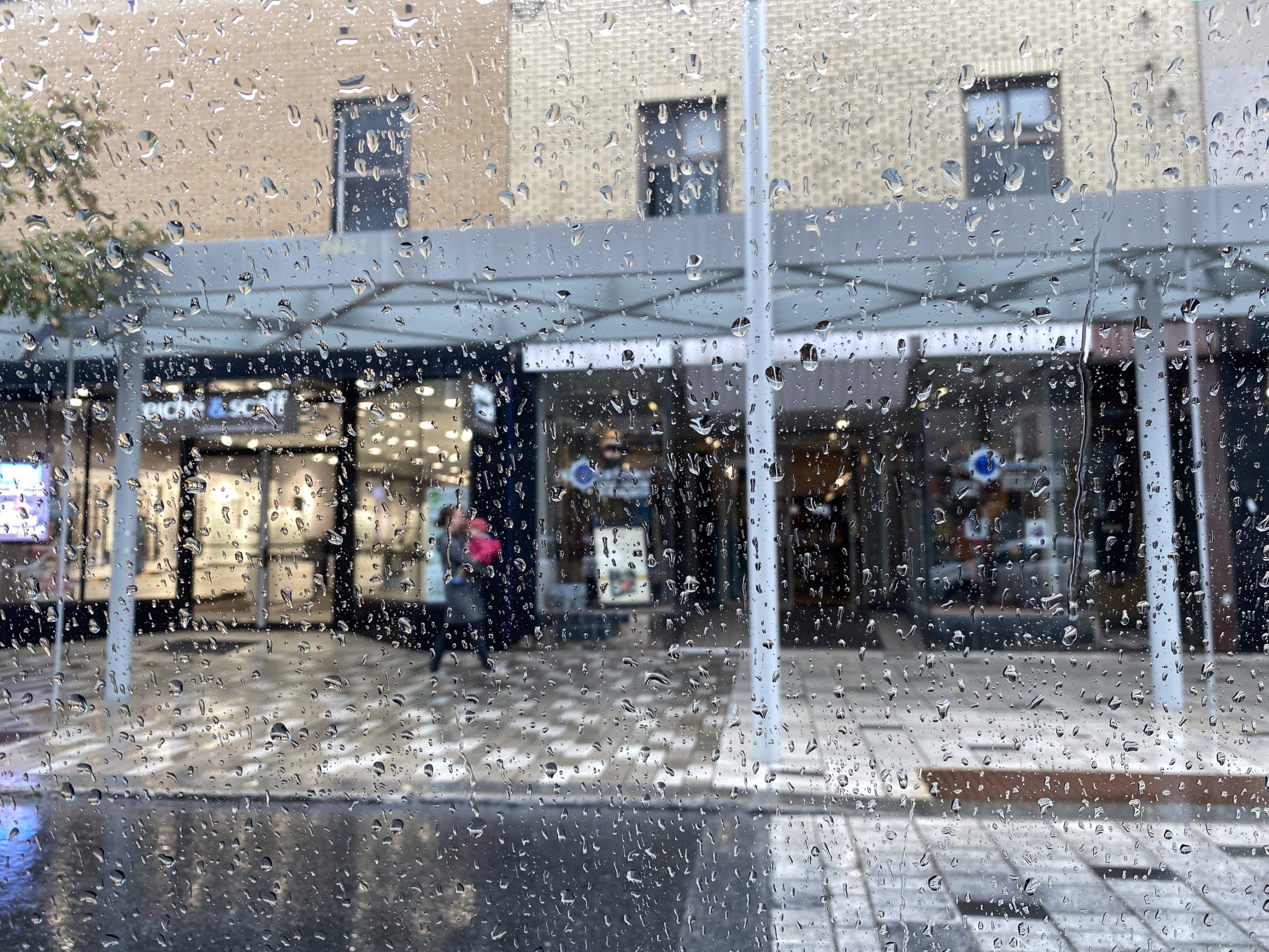
Montreal is bracing for another round of rain this weekend, with rainfall amounts of up to 40 mm expected Sunday afternoon and evening. However, unlike the recent flooding caused by tropical storm Debby, this weekend's rain is not expected to cause widespread flooding.
Environment Canada has issued a special weather statement warning of significant rainfall amounts this weekend. The heaviest precipitations are expected to fall beginning Sunday afternoon until Monday morning.
Rainfall amounts between 20 and 30 millimetres and up to 40 mm in thunderstorms are expected Sunday afternoon and evening.
Water accumulations are possible in the already saturated low lying areas. In addition, this rain may have an impact near watercourses and on infrastructures previously affected by the heavy rains associated with post-tropical storm Debby.
Residents should remain vigilant in case of heavy rain and continue to monitor alerts and forecasts issued by Environment Canada.
Montreal Weather: A History of Flooding
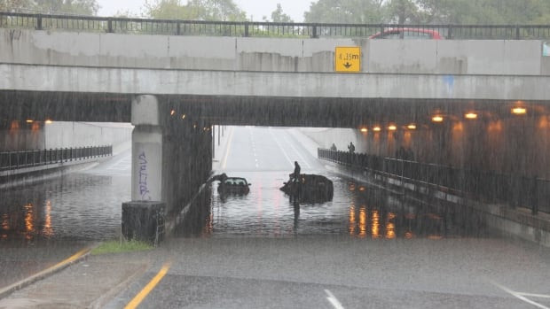
Montreal has a history of flooding, and the recent floods caused by tropical storm Debby were particularly severe. Up to 200 millimetres of rain fell on Montreal and surrounding areas on Aug. 9, causing flooding and power outages.
The flooding was so severe that it closed Highway 13, a major artery in the city. The highway was finally reopened on Thursday morning after being closed for five days.
The flooding also caused damage to infrastructure, including a pumping station that was damaged by the floodwaters.
The Forecast for This Weekend
While the rain this weekend is not expected to be as heavy as the rain that caused the flooding last week, it is still important to be prepared.
Environment Canada has issued a special weather statement warning of significant rainfall amounts this weekend. The heaviest precipitations are expected to fall beginning Sunday afternoon until Monday morning.
Rainfall amounts between 20 and 30 millimetres and up to 40 mm in thunderstorms are expected Sunday afternoon and evening.
Water accumulations are possible in the already saturated low lying areas. In addition, this rain may have an impact near watercourses and on infrastructures previously affected by the heavy rains associated with post-tropical storm Debby.
Residents should remain vigilant in case of heavy rain and continue to monitor alerts and forecasts issued by Environment Canada.
Staying Safe During Heavy Rain
There are a few things that residents can do to stay safe during heavy rain:
-
Monitor weather alerts and forecasts. Environment Canada issues weather alerts and forecasts for the Montreal area, and it is important to stay up to date on the latest information.
-
Be prepared for flooding. If you live in a low-lying area, be prepared for flooding. This means having a plan in place for where you will go if you need to evacuate your home.
-
Avoid driving through floodwaters. Floodwaters can be very dangerous, and it is important to avoid driving through them. Even if the water looks shallow, it can be deep enough to stall your car or even sweep it away.
-
Be aware of your surroundings. Pay attention to your surroundings and be aware of any potential hazards.
-
Stay informed. The Gazette will continue to provide updates on the weather and the situation in Montreal. You can also get information from Environment Canada and other local news sources.
The Impact of Climate Change
The recent flooding in Montreal is a reminder of the impact that climate change is having on our communities. Climate change is leading to more extreme weather events, including heavy rain and flooding.
It is important for us to take action to address climate change. This means reducing our emissions and preparing for the impacts of climate change.
Looking Ahead
Montreal is expected to remain in an unsettled pattern through at least next Monday. Primarily we will be affected by the departing upper level low to the east of our region, with scattered storms moving from north to south. With any thunderstorm activity, heavy rain is possible, but the storms will not impact the entire island of Montreal the way Debby did. Temperatures will be quite warm Thursday through Saturday, rising to near 30C (86F) each day, as it did Wednesday afternoon.
Over the weekend, we have another Great Lakes low pressure and associated frontal boundary that is expected to slide across southern Quebec. Showers and scattered thunderstorms are likely each day, with the possibility of 15-25mm of rain falling by Monday, perhaps more in thunderstorms. The hope at this time is that we avoid any additional flooding. Time will tell.
The good news is that Hurricane Ernesto, which has strengthened into a hurricane Thursday morning, will not impact southwestern Quebec. The storm will be too far out in the open waters of the North Atlantic.
Ernesto strengthened into a hurricane Thursday morning, located 915 km southwest of Bermuda with 140km/h winds. the storm was moving north at 22km/h. A hurricane warnings is in effect for Bermuda, with the centre expected to pass close to the island nation Saturday as a major hurricane. The storm will produce dangerous surf along the entire US coast and into Atlantic Canada. Ernesto may brush coastal Nova Scotia, but most likely will affect southeastern Newfoundland sometime next week.