Those who want to get alerts about flood risks do need to create an account that allows individualized text messaging, but there is no charge to sign up.
Some of the information FIMAN uses was already available online from the U.S. Geological Survey and the U.S. Army Corps of Engineers, but FIMAN combines it with data from the N.C. Department of Transportation’s flood warning system, local governments and some private agencies and makes it searchable by location and other categories.
How to Use FIMAN
Users go to the website and open the map of the state, where the locations of 585 gauges populate the screen as green dots. Any dot circled in another color — orange, red or purple — indicates a site where minor, moderate or major flooding is expected.
Clicking on a gauge can provide information about what the water level is now, when and how high it’s expected to peak, and the height of the water at its historical record flood. FIMAN also uses satellite mapping to show what development may be present near the streams.
Clicking on the menu and search bars allows users to enter particular addresses or search by towns or stream names to get information about potential flooding.
Flooding Potential in North Carolina
On Tuesday afternoon, FIMAN showed only two gauges where major flooding is expected as a result of the heavy rains forecasters say Debby will bring by Friday night: the Black River near Tomahawk, in rural Sampson County, and the Lumber River in Lumberton.
According to FIMAN, moderate flooding is expected on the Neuse River at Goldsboro, the Cape Fear River at Burgaw and the Little River at Spring Lake.
Staying Prepared for Floods
WRAL meteorologists are closely watching the levels of several North Carolina rivers as Debby inches closes to North Carolina.
North Carolina's interactive Flood Inundation Mapping and Alert Network (FIMAN) map uses more than 500 gauges to show what rivers are close to moderate and major flood stage. There are several rivers east of the Triangle that WRAL meteorologists will be watching closely in the coming days.
The latest river forecasts from National Weather Service are listed below. These forecasts can change depending on how much rain actually falls. Even moderate flood stage can cause minor flooding issues, according to WRAL meteorologist Elizabeth Gardner.
“As rain falls, it goes into the soil and then goes into the river,” WRAL meteorologist Chris Michaels explained. “This is why you'll often see river levels rise to their highest levels days after the last rain drop falls.”
Rivers flow eastward and downstream into the Atlantic Ocean, so rivers farther east face a higher flood threat than those farther west. However, according to Michaels, that may change if rain totals exceed expectations in areas like the Triad.
The Importance of FIMAN
People can click the alarm icon in the top right corner of the map to be notified if a river is flooding in their area.
The map also shows historical rainfall events that caused rivers to flood.
In September 2018, Hurricane Florence dumped 8 trillion gallons of water across North Carolina. It happened just two years after Hurricane Matthew brought devastating rainfall to the same area.
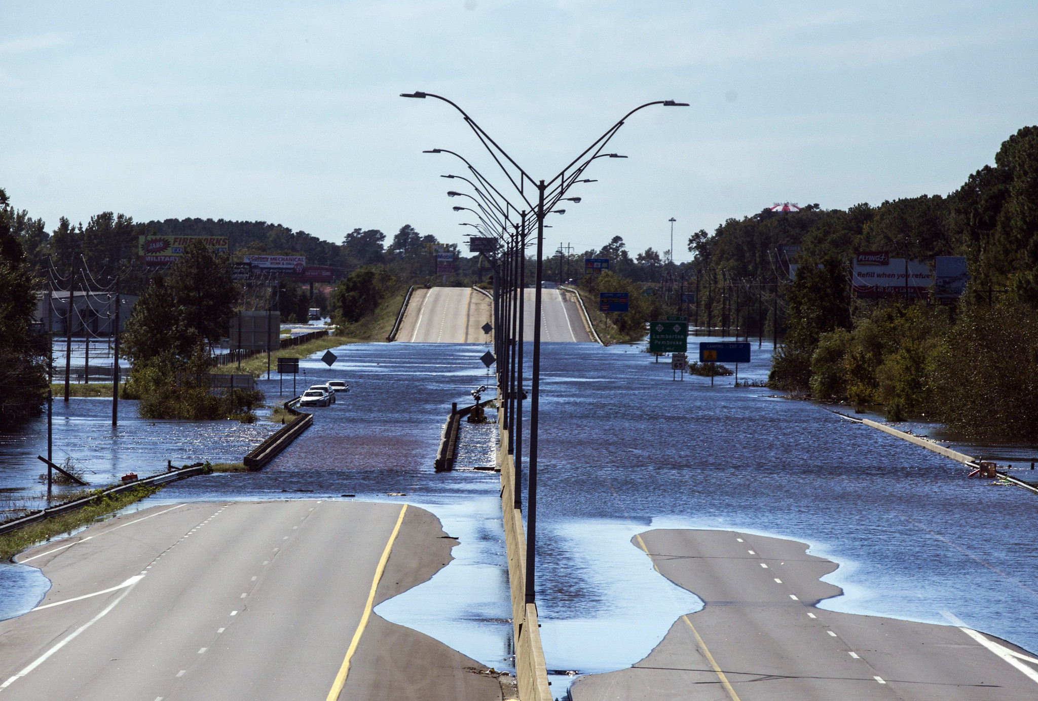
Both Matthew and Florence brought record flooding to North Carolina’s rivers. During Matthew, the Lumber River in Lumberton crested at 28 feet, the highest it ever had. That record was shattered when Florence crested the river just two years later at 29 feet and covered parts of Interstate 95.
The Neuse River in Goldsboro also crested to record levels during Matthew, rising to 29.74 feet. Two years later, during Florence, it reached the third highest crest on record at 27.6 feet.
The Cape Fear River in Fayetteville also reached astonishing levels, topping out at the sixth highest crest on record during Matthew at 58.94 feet. Two years later, Florence helped it record the fifth highest crest on record, at 61.58 feet.
The rivers remained above flood stage for weeks after the storms passed.
Looking Ahead
FIMAN is a valuable tool for residents and officials in North Carolina, providing critical information and alerts that help communities prepare for and respond to flood events. By utilizing FIMAN, individuals can stay informed about potential flooding risks and take proactive measures to protect themselves and their property. As hurricane season approaches, FIMAN continues to play a vital role in ensuring the safety and resilience of North Carolina communities.