The Outer Banks is currently facing coastal flooding due to abnormally high tides and elevated east-northeasterly swell, according to the National Weather Service (NWS) Newport/Morehead City office. The flood advisory, which remained in effect until Tuesday afternoon from Duck to Ocracoke Village, warned of minor to locally moderate flooding.
Coastal Flooding Impacts on the Outer Banks
The NWS forecast predicted that although abnormally high tides had already peaked and were on the downtrend, they would still produce minor to locally moderate coastal flooding into Tuesday. As tide levels slowly fall, building swell from a distant offshore low will continue to produce elevated water levels, especially north of Cape Hatteras.
Flooding impacts were expected to be enhanced in areas with recently compromised dune structures, especially around Tuesday's high tide at 2:00 p.m. Water level rises of 1 to 2 feet above ground on the oceanside and up to one foot above ground on the soundside were expected to continue.
Localized ocean overwash was reported on Monday afternoon on the northern end of Ocracoke Island, in northern Buxton, in Rodanthe, and on Pea Island. Despite the overwash, N.C. Highway 12 remained open throughout the day, however, travelers were advised to use caution.
Travel Impacts and Road Closures
N.C. Highway 12, a vital thoroughfare connecting the Outer Banks communities, was impacted by the high tides and swell. The N.C. Department of Transportation (NCDOT) reported that N.C. 12 on Ocracoke Island remained open and passable with extreme caution and reduced speed, as crews worked to clear water and sand. However, the road was closed for a couple of days earlier in the week when high surf wiped out dunes along the road.
The NCDOT personnel were on the road on Tuesday to clear water and sand as needed, and travelers were advised to slow down and use caution during the ongoing work. The NCDOT said that N.C. 12 on Ocracoke Island remains open and passable with extreme caution and reduced speed. The opening of the Rodanthe “Jug-Handle” Bridge in 2022 has also helped in the fight against the erosion impact of these storms. The presence of high surf and winds was also top of mind, as this weather was expected to stick around the Outer Banks this week.
Homes Collapse on Hatteras Island
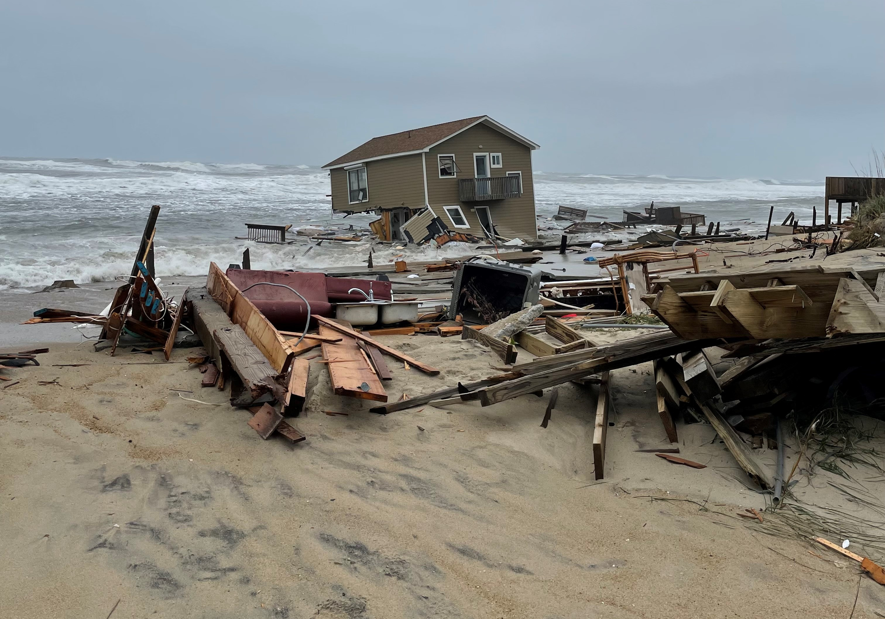
The rough surf and higher than normal tides on Hatteras Island contributed to a pair of houses on G.A. Kohler Court in Rodanthe collapsing on Friday. Debris from the collapsed homes spread more than 20 miles to the south between Avon and Buxton over the weekend, with National Park Service personnel, contractors hired by one of the homeowners, and volunteers all working to pick-up the remains. This incident highlights the vulnerability of coastal areas to extreme weather events, and underscores the importance of building resilience in the face of climate change.
Preparing for the Future
The NCDOT is working to address the issue of coastal erosion, which is a significant threat to the Outer Banks. The agency is investing in projects to strengthen dunes, reinforce roads, and build bridges to improve the resilience of the region.
The NCDOT Ferry Division provides real-time text or email alerts from their routes via the Ferry Information Notification System (FINS) at www.ncdot.gov/fins. System-wide route status updates will also be posted on the Ferry Division's Twitter and Facebook pages.
Looking Ahead
The National Hurricane Center is closely monitoring a disturbance in the western Caribbean that is forecast to develop into a tropical cyclone and threaten the Gulf Coast states by late this week. While it's still too early to know if this system will bring any impacts to eastern North Carolina, most models keep the center of circulation well to our west.
It is essential to stay informed about weather conditions and advisories to ensure safety during these events. By understanding the risks and taking appropriate precautions, we can minimize the impact of coastal flooding and other extreme weather events.
A Call to Action
The Outer Banks is a beautiful and popular destination, but it's important to remember that it's also a fragile ecosystem. As climate change intensifies, we can expect to see more frequent and severe weather events. We must take action to protect our coastal communities and prepare for the future.
This includes investing in resilient infrastructure, promoting sustainable development, and educating the public about the importance of climate action. By working together, we can build a more resilient and sustainable future for the Outer Banks and our entire planet.
End Note
While this recent coastal flooding event was relatively minor, it serves as a reminder of the vulnerability of coastal areas to extreme weather events. As climate change continues to alter weather patterns, it is vital to prepare for more frequent and severe storms. We must take action to protect our coastal communities and build resilience for the future.
This is more than just an environmental issue; it is a matter of public safety and economic security. By understanding the risks and taking appropriate action, we can create a more resilient and sustainable future for the Outer Banks and beyond.


