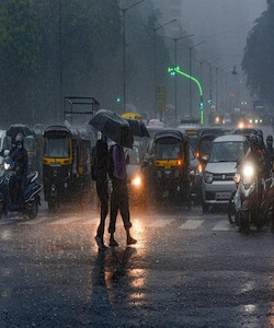
Over 100 mm of rain is possible in some of the hardest-hit areas of the Prairies this week, as a potent system stalls and brings heavy rain and strong winds to the region. After Monday saw tornado warnings issued in Manitoba and northwestern Ontario, another risk of stormy, soggy weather is in store for a good portion of the Prairies come Tuesday and beyond.
Some areas are in line to see more than 100 mm of rainfall through Thursday thanks to a potent stateside system that will slowly move eastward over the region. With the onslaught of soaking rains, the risk for localized flooding will increase.
It will be important to pay close attention to the latest alerts in case severe weather occurs. Have a plan in place to seek safe shelter in case severe weather threatens your home, your office, or while you’re driving.
On Tuesday, thunderstorms are possible, albeit scattered in nature, across Saskatchewan. As sunset approaches, instability grows and the Montana low approaches the international border.
This is where the uncertainty lies on how strong the thunderstorms will be.
By the overnight period, however, the low becomes stronger and more organized. Expect several rain bands to pivot in from Montana.
As well, the setup will be favourable for severe thunderstorms within the rain bands, and will continue into Wednesday morning. Strong winds and heavy downpours are possible with the nocturnal storms.
On Wednesday, the deepening low will create strong, northwesterly wind gusts across Alberta and Saskatchewan, with up to 80 km/h gusts possible.
Peak rainfall rates will occur Wednesday afternoon and evening, with the heaviest rain forecast in western Saskatchewan.
Some communities near the Alberta-Saskatchewan border could see more than 100 mm of rain through Thursday as this storm passes through the region, which heightens the risk for localized flooding.
By Thursday afternoon, the low will weaken and gradually shift north and east.
Meanwhile, cooler air filtering in on the western side of the system will keep temperatures well below seasonal across southern Alberta. Calgary and Lethbridge will struggle to climb into the mid-teens on Wednesday.
Additional showers are expected late week for parts of the region, and the potential for another system for southern Manitoba to end the weekend. Temperatures will be on the warm side of seasonal for the next week, especially for eastern parts of the region.
Saskatchewan in the Line of Fire
Saskatchewan, particularly the southwest, is about to be hit by a significant dump of rain. A low-pressure storm system over Montana is expected to move north into the province by Tuesday afternoon, although the majority of areas in the line of the storm will see rain by the evening.
Environment and Climate Change Canada tells CBC that southwest Saskatchewan can expect between 40 and 70 millimetres of rain in and around Maple Creek, Swift Current, Leader and Kindersley. Saskatoon will also see a good chunk of rain. And, due to thunderstorms, some areas can expect pockets of rainfall to exceed 90 or even 100 millimetres.
“It’s going to be quite a rare event,” said Stephen Berg, meteorologist with Environment and Climate Change Canada.
“This is certainly looking like a severe event in terms of rainfall in some places. [We] might have some localized flooding in places that have harder ground, more impermeable surfaces. If it’s an urban area, that might be a big concern for some overland flooding there.”
Hydroplaning is a risk due to surface water on the roads, Berg said. He advises people to not drive in those areas as there’s a big risk of sliding off the road.
“Visibility might be quite reduced, maybe to as much as a half a mile. So that might also pose a major issue in terms of seeing the road ahead of you,” Berg said.
The meteorologist predicts the next few days will be especially difficult for farmers.
“With the harvest ongoing, it might be a bit of a problem for farmers in those areas getting the crops out of the ground,” he said.
Regina might avoid the heaviest precipitation, with current projections sitting between 10 and 25 millimetres of rainfall. However, a thunderstorm may increase that, according to Berg.
The weather system is expected to last from Tuesday to Thursday. Berg said the rain swath will then move toward the northeast corner of the province on Friday.
A Thunderstorm Threat
There is a chance that a thunderstorm may hit Foothills County today. According to Warning Preparedness Meteorologist with Environment & Climate Change Canada, Alysa Pederson, a thunderstorm may move across Southern Alberta today.
“It’s not a common thing for September, but it’s absolutely possible right into October, November,” Pederson explains. “But, yeah, there is a risk of thunderstorms in the Foothills of Alberta today and extending eastwards across southern Alberta towards Medicine Hat as well.”
Pederson says that they aren’t expecting the thunderstorms to be too bad.
“What the system is looking like right now, they’re just kind of your air mass thunderstorms. Might be some lighting strikes associated with agitated cumulus clouds. So, they’re not looking to be too significant, but with thunderstorms, you get lighting and there’s severity risk with that as well.”
Other than the risk of thunderstorms today, there isn’t much to look out for, weather-wise, until the weather cools off on Thursday night. Pederson adds that in September, it is normal for the temperatures to fluctuate from day to day, with the normal temperature for this time of year being around the 16-degree mark.
“So, that’s what it looks like for the weekend here coming up. September is a little bit of a roller coaster month when it comes to temperatures and weather. It’s always a good idea to be prepared for changing weather.”
Heavy Rainfall Expected in Southwestern Saskatchewan
Grab your umbrella, it sounds like there will be some stormy and showery conditions over the next couple of days in parts of Saskatchewan. “This is quite a bit of rain for any time of year,” said Environment Canada Meteorologist Justin Shaer.
The southwest corner of the province is expected to get 50 to 100 millimetres — or 2 to 4 inches — of rain, from now into Thursday morning. “Especially over the Cypress Hills, just with the higher terrain, that does create some interactions. You get kind of more atmospheric lift, more precipitation will occur there.”
Shaer said that areas around Leader, Swift Current and Kindersley are also expected to see significant rainfall over the next two days. However, a lot less rain is expected in Regina and Saskatoon.
In the Queen City, around 10 to 20 millimetres — or less than an inch — of rain is expected to fall over the next couple of days. Saskatoon is expected to see more, with up to 25 to 35 millimetres — or around an inch — of rain.
Shaer explained that with this system moving through, conditions will be quite variable over short distances. “Just the just the nature of the showery weather and thunderstorms, you can have pockets where kind of one bubble goes up, and there’s nothing really beside it; and then if you’re under those thunderstorms, it’s going to be quite a heavy downpour.”
The rain is not the news many farmers want to hear during harvest. “If you’re not wanting rain, then, no, this is absolutely not going to be a good thing for harvest right now; typically, I’ve always heard a bit of a drier September into October would be more ideal,” said Shaer.
A Second System is Expected to Bring Additional Precipitation
In addition, Lerner said rain for the United States Northern Plains and Midwest will depend on the specific area. Also, he stated a full-blown La Nina is very unlikely to occur going into winter.
Lerner explained that second system, forecast for Sept. 18-19, is to bring one to 2.5 inches of rain to much of western Saskatchewan. “The moisture is really needed, but it’s going to cause some significant delays to field work,” Lerner commented. “A lot of that area that’s going to be impacted received last week’s rain. So some areas are going to be a little too wet.”
The forecaster said the rest of the Prairies will receive less rain. “The rain will be lighter than normal in eastern Saskatchewan and northwest Manitoba, and probably lighter than normal the Peace country, in the Swan Hills and Slave Lake area in northwest Alberta. Everybody else will be near normal,” he added.
For the U.S., Lerner said the Northern Plains will receive much of the same weather. The central area of Montana will likely get rain while there’s a dry bias for eastern part of the state and extending into the western part of North Dakota. “We will see a fair amount of moisture in Minnesota and the eastern part of North Dakota,” he added, noting there are to be light showers for South Dakota.
As for the U.S. Midwest, Lerner predicted normal rainfall for the eastern half of the Corn Belt, while the western half is to get “a couple of rounds of precipitation with some disruption of farming activity. But it shouldn’t be so great that they can’t get anything done.”
A Wet Start to the Week: Heavy Rain and Thunderstorms Threaten Parts of the Prairies
We're in for another active start to the week across the Prairies, and parts of northwestern Ontario, with multiple areas under the threat for heavy rain and strong thunderstorms. The severe set up prompted tornado watches in Ontario Monday morning.
Gusty winds, widespread heavy rainfall, large hail, and unseasonable warmth, will all accompany the storm as it treks into Canada. It will feel remarkably similar to what we experienced last week on the Prairies, with back-to-back days of unsettled conditions and the risk for severe thunderstorms.
A risk for severe weather will develop over portions of the southern Prairies during the day Monday and extend through the overnight hours into Tuesday morning, as well. Thunderstorms will initially develop over North Dakota during the day Monday. These storms will push north along a warm front through the afternoon and evening hours, eventually tracking into southern Manitoba and northwestern Ontario. This threat includes the City of Winnipeg, where there’s the risk for torrential rainfall, strong winds and large hail up to golf ball-size.
If the warm front from North Dakota crosses into northwestern Ontario through the afternoon, that could bring the chance of a tornado or two in northwestern Ontario. With the cluster of the storms continuing through the overnight hours, there’s the chance it could lead to some localized flooding.
Farther west, we have to watch the bulk of the low as it meanders over Saskatchewan and Alberta. Several days of widespread heavy rainfall will accompany the storm as it moves into Canada, with the heaviest precipitation targeting areas of eastern Alberta and western Saskatchewan.
Tuesday features more scattered precipitation, but by Wednesday, more organized rainbands will pivot in from Montana, reaching peak rainfall rates by Wednesday afternoon and evening. By Thursday afternoon, the low will weaken and gradually shift east. Some communities near the provincial border could see up to 100 mm of rain through Thursday as this storm passes through the region.
Gusty northwesterly winds will blow across Alberta and western Saskatchewan for the duration of the storm, as well. Folks can expect gusts up to 80 km/h in parts of Alberta, with gusts of 70 km/h possible in Saskatchewan.
Summer-like temperatures on the eastern side of the storm will send readings as much as 9°C above seasonal on Monday and Tuesday, especially in Manitoba including Winnipeg and Dauphin. Meanwhile, cooler air filtering in on the western side of the system will keep temperatures well below seasonal across southern Alberta. Calgary and Lethbridge will struggle to climb into the mid-teens on Wednesday.