Just a few scattered showers are ongoing in the Northern Plains and upper Midwest at this time. We expect the threat of severe weather to increase by this afternoon and then continue into the evening hours.
Monday-Monday Night
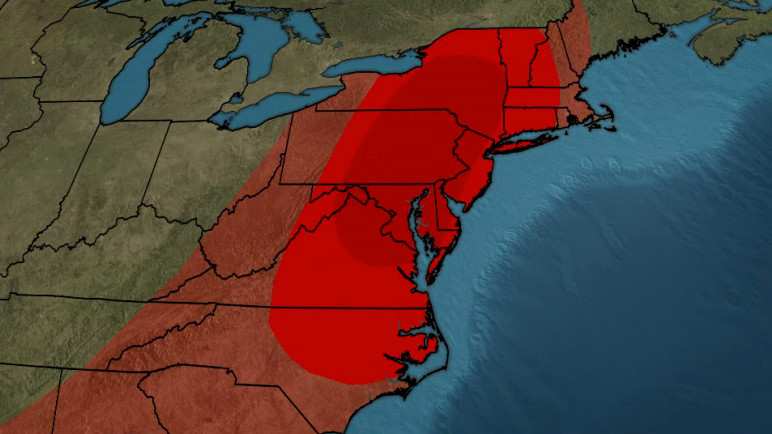
Two different low-pressure systems keep much of the Northeast active as we kick off the workweek. An oddly shaped marginal risk (level 1 out of 5) is issued for the threat of seeing pockets of large hail and strong winds. It includes areas from the Nation's Capital, New York City, Philadelphia, and Albany. There's even a slight risk (level 2 out of 5) in much of New England, including the city of Boston. Storms will be isolated in the early afternoon and become more scattered in the evening hours, before calming down overnight.
On Monday at 3:17 p.m. the National Weather Service issued an updated severe thunderstorm warning for Bristol County. The storms could bring wind gusts of up to 60 mph and golf-ball-sized hail (1.75 inches). "At 3:17 p.m., a severe thunderstorm was located over Warwick, moving southeast at 20 mph," according to the weather service. "People and animals outdoors will be injured. Expect hail damage to roofs, siding, windows, and vehicles. Expect wind damage to trees and power lines." Locations impacted by the warning include Warwick, Cranston, East Providence, Coventry, West Warwick, North Kingstown, Newport, Bristol, Portsmouth, Barrington, Middletown, Narragansett, Tiverton, Westport, East Greenwich, Warren, Exeter, West Greenwich, Jamestown and Little Compton.
Tuesday-Tuesday Night
As our second system starts to reach the Great Lakes on Tuesday, the severe outlook follows it. Our marginal and slight risks follow the shorelines of Lake Erie and Ontario. A few isolated storms have the possibility of producing strong winds and some hail in the second half of the day.
Wednesday-Wednesday Night
The same low-pressure system is responsible for a large slight risk from Detroit through New York City on Wednesday. Given this is three days away, it goes to show the Storm Prediction Centers (SPC) confidence in our chance of seeing some severe storms by the middle of the workweek.
Beyond Wednesday
With a few rounds of storms, some localized areas could pick up 2 inches of rain or more, which could spark some flash flooding. Keep that in mind to start the workweek!
An updated weather alert was issued by the National Weather Service on Monday at 3:51 p.m. for strong thunderstorms until 4:45 p.m. Prepare for pea-sized hail (0.25 inches) and wind gusts of up to 40 mph. “At 3:51 p.m., Doppler radar tracked a strong thunderstorm 7 miles southeast of Bermuda Run, or 9 miles northwest of Lexington, moving southeast at 10 mph,” according to the NWS. “Gusty winds could knock down tree limbs and blow around unsecured objects. Minor hail damage to vegetation is possible.” Locations impacted by the alert include High Point, Lexington, Thomasville, Linwood, Arcadia, Gordontown, High Rock Boat Dock Marina, Welcome, Nc Wildlife Access Boat Launch and High Rock Lake Marina & Campground.
The NWS adds, “If outdoors, consider seeking shelter inside a building.”
On Sunday at 4:17 p.m. an updated severe thunderstorm warning was issued by the National Weather Service valid until 4:30 p.m. for Sussex County. The storms could bring penny-sized hail (0.75 inches) and wind gusts of up to 60 mph. "At 4:16 p.m., a severe thunderstorm was located over Ogdensburg, or near Newton, moving southeast at 15 mph," states the weather service. "Damage to roofs, siding, trees, and power lines is possible." Locations impacted by the warning include Newton, Hopatcong, Franklin, Hamburg, Ogdensburg, Branchville, Lake Mohawk and Pellettown.
The weather service adds, "For your protection move to an interior room on the lowest floor of a building."
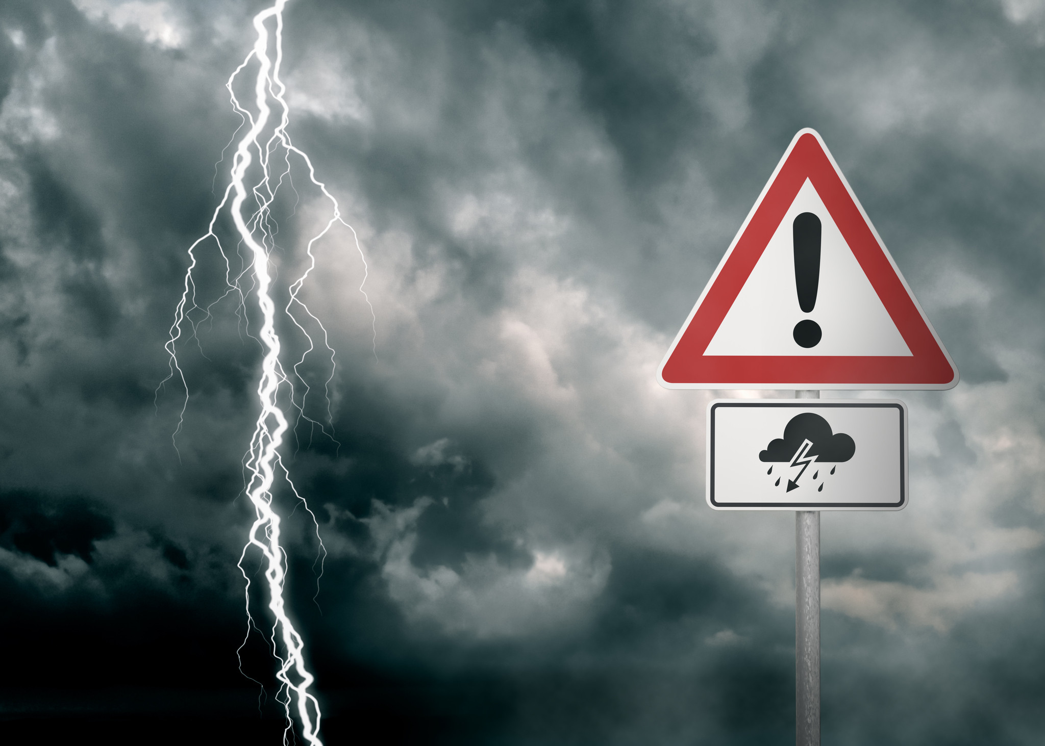
Staying Safe During Thunderstorms
Lightning strikes the United States approximately 25 million times each year, with the bulk of these electrical discharges occurring during the summer months. Tragically, lightning claims the lives of about 20 individuals annually, as reported by the weather service. The risk of lightning-related incidents escalates as thunderstorms draw near, reaching its peak when the storm directly looms overhead. However, it gradually recedes as the tempest moves away.
To ensure your safety during a thunderstorm, consider the following recommendations:
Lightning safety plan
- Have a plan in place for what to do if a thunderstorm approaches. This should include where you will go for shelter and how you will communicate with family and friends.
Indoors safety measures
- Stay indoors during thunderstorms, especially if you are near a window. If you are in a house, avoid using electrical appliances, plumbing, and telephones as these can provide a path for lightning to enter the building.
- If you are in a large building, seek out the lowest floor, preferably an interior room away from windows.
Wait for the all-clear
- Don’t return outdoors until 30 minutes after the last sound of thunder or the storm has passed.
When indoor shelter isn't available
- If you are outdoors and a thunderstorm approaches, seek shelter immediately. If no indoor shelter is available, avoid open fields, tall trees, water, metal objects, and vehicles. The safest place to be is inside a hard-top vehicle, with the windows closed.
If you find yourself outdoors with no access to indoor shelter during a thunderstorm, take these steps to maximize your safety:
- Find the lowest spot possible, such as a ditch or ravine.
- Crouch down and put your head between your knees, covering your ears with your hands.
- Stay away from any metal objects, including fences, pipes, and even golf clubs.
- If you are in a group, spread out to minimize the risk of multiple people being struck by lightning.
Staying Safe During Heavy Rain
When heavy rain pours, the risk of flooding and treacherous roads rises. Here's your guide from the weather service to staying safe during downpours:
Beware of rapid water flow
In heavy rain, refrain from parking or walking near culverts or drainage ditches, where swift-moving water can pose a grave danger.
Maintain safe driving distances
Adhere to the two-second rule for maintaining a safe following distance behind the vehicle in front of you. In heavy rain, allow an additional two seconds of distance to compensate for reduced traction and braking effectiveness.
Slow down and stay cautious
On wet roads, slowing down is paramount. Gradually ease off the accelerator and avoid abrupt braking to prevent skidding.
Choose your lane wisely
Stick to the middle lanes on multi-lane roads to minimize the risk of hydroplaning, as water tends to accumulate in outer lanes.
Visibility matters
Enhance your visibility in heavy rain by activating your headlights. Be particularly vigilant for vehicles in blind spots, as rain-smeared windows can obscure them.
Watch out for slippery roads
The first half-hour of rain is when roads are slickest due to a mix of rain, grime, and oil. Exercise heightened caution during this period.
Keep a safe distance from large vehicles
Don't follow large trucks or buses too closely. The spray created by their large tires reduces your vision. Take care when passing them as well; if you must pass, do so quickly and safely.
Mind your windshield wipers
Overloaded wiper blades can hinder visibility. If rain severely limits your sight, pull over and wait for conditions to improve. Seek refuge at rest areas or protected spots.
Pulling off the road in heavy rain
If the roadside is your only option, pull off as far as possible, preferably past the end of a guard rail, and wait until the storm passes. Keep your headlights on and turn on emergency flashers to alert other drivers of your position.
In the face of heavy rain, these precautions can make a significant difference in ensuring your safety on the road. Remember to stay informed about weather conditions and heed guidance from local authorities for a secure journey.