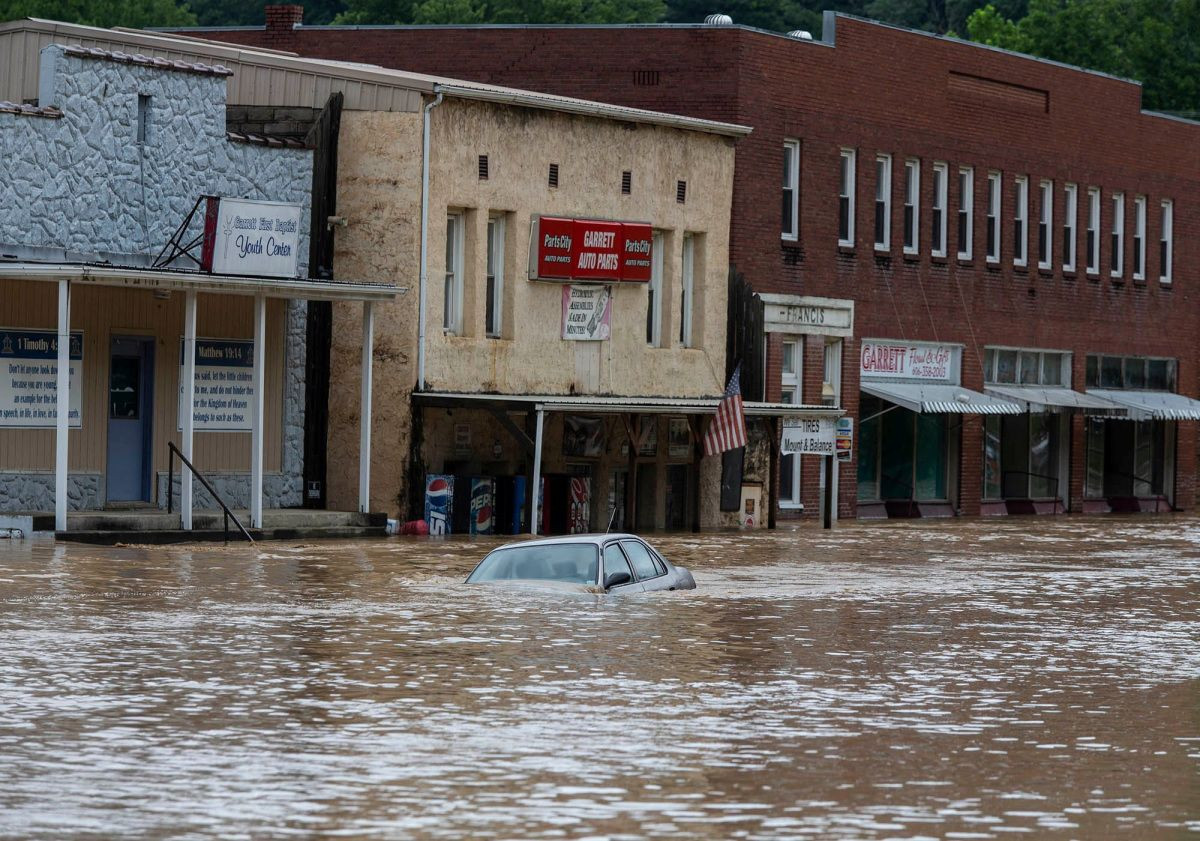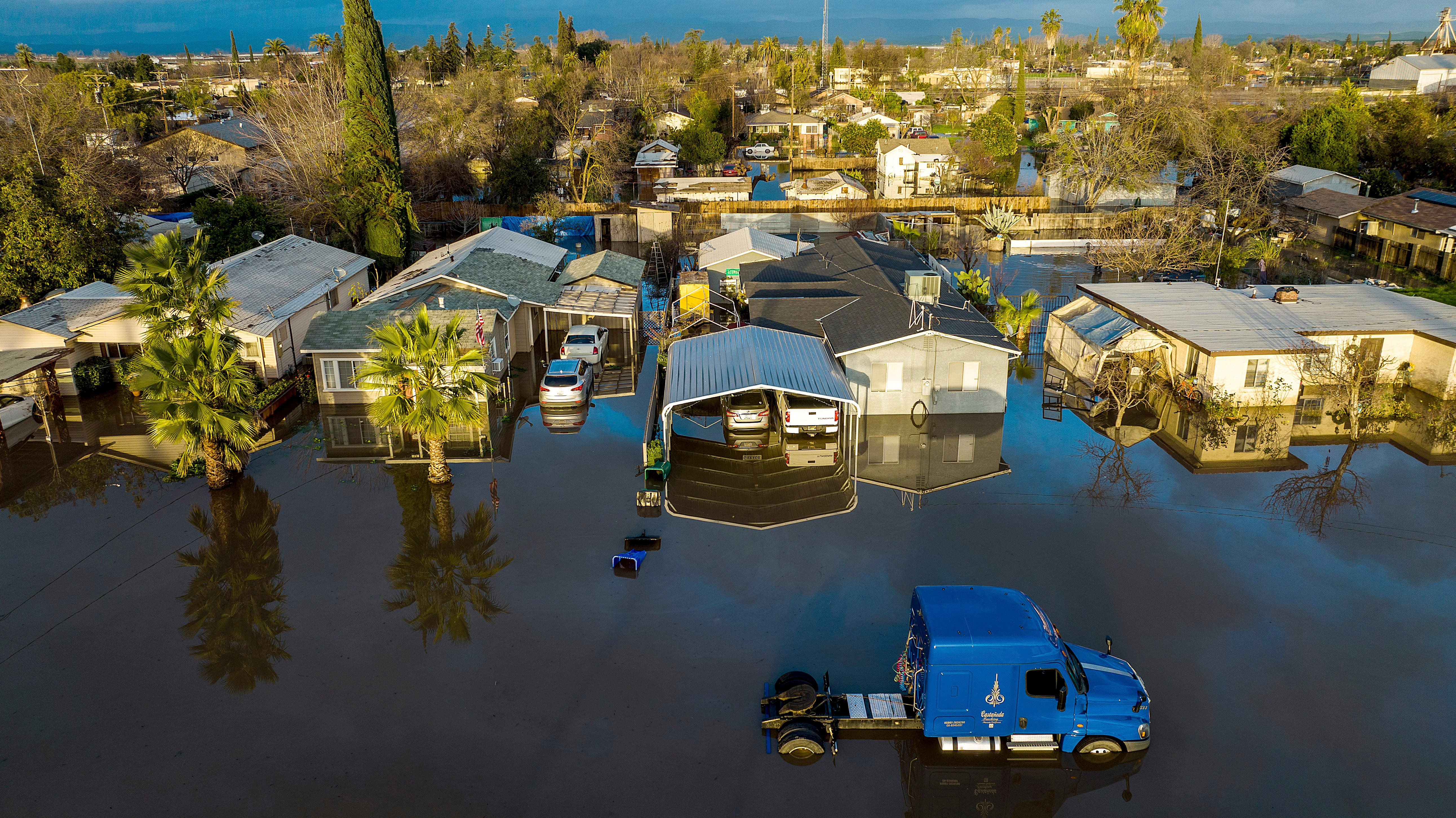
Rare September thunderstorms unleashed a torrent of rain and even hail across parts of Southern California on Friday, triggering widespread flooding concerns, particularly in areas recently ravaged by wildfires. The Inland Empire, encompassing the desert and mountain communities, bore the brunt of the thunderstorm activity during the afternoon hours, leading to a flash flood warning that gripped San Bernardino County until 5:30 p.m. The National Weather Service reported up to an inch of rain in the area, raising anxieties about the potential for mudflows and debris in the wake of recent wildfires.
The flash flood warning encompassed several key locations, including San Bernardino, Redlands, Yucaipa, Highland, Running Springs, Highway 18 between Running Springs and Big Bear, Highway 330 between San Bernardino and Running Springs, Angelus Oaks, Highway 18 between Running Springs and Skyforest, and Mountain Home Village. In addition to the Inland Empire, the low desert regions witnessed thunderstorm activity, with notable occurrences around Palm Springs, just east of Desert Hot Springs, and south of Yucca Valley. Meanwhile, residents in Redlands and Riverside encountered rain around noon.
The Los Angeles County Sheriff's Department identified several unincorporated communities as potentially vulnerable to flooding, including Mount Baldy, Wrightwood, Big Pines, Agua Dulce, and Santa Maria. These communities, along with the burn scar areas, are especially susceptible to the destructive forces of flash flooding and debris flows due to the absence of vegetation and the compromised soil's ability to absorb water.
Adding to the dire situation, the Bridge, Line, and Airport fires, the three largest active wildfires in California, have scorched more than 117,500 acres and destroyed at least 234 structures. While firefighters have made significant progress in containing the blazes, the persistent threat of heavy rainfall and the potential for mudflows remain a pressing concern.
The Line Fire and Flash Flood Warning
Thunderstorms carrying heavy rainfall rates moved into the area near the Line Fire, a substantial wildfire currently engulfing San Bernardino County. The storms, though not particularly severe, dumped rainfall rates ranging from half an inch to 0.75 inches, escalating the flash flooding threat over burn scar areas. The storms were attributed to a low-pressure system traversing the region, according to National Weather Service (NWS) meteorologist Sam Zuber.
The NWS San Diego office issued the flash flood warning at 2:17 p.m. Pacific Daylight Time, with the warning expected to remain in effect until 5:30 p.m. PDT. The warning stated that Doppler radar indicated thunderstorms generating heavy rain across the targeted area, with rainfall accumulations reaching 0.25 to 1 inch. The warning also cautioned that additional rainfall amounts of 0.25 to 1.25 inches were possible in the warned area. It further highlighted that flash flooding was ongoing or anticipated to begin shortly.
Life-Threatening Flood Risks and Urgent Precautions
The flash flood warning emphasized the life-threatening nature of the flooding and the potential for widespread inundation, including creeks, streams, urban areas, highways, streets, and underpasses. Areas most susceptible to flash floods included San Bernardino, Redlands, Yucaipa, Highland, Running Springs, Highway 18 between Running Springs and Big Bear, Highway 330 between San Bernardino and Running Springs, Angelus Oaks, Highway 18 between Running Springs and Skyforest, and Mountain Home Village.
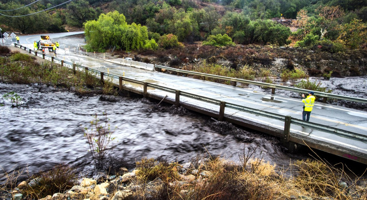
Meteorologists issued a dire warning to motorists in the region, urging them to turn around when encountering flooded roadways. The alert highlighted the alarming reality that most flood deaths occur in vehicles. In light of the heightened risk, authorities urged residents to steer clear of recently burned areas, emphasizing the likelihood of life-threatening flooding in creeks, roads, and normally dry arroyos. They also emphasized the possibility of rockslides, mudslides, and debris flows in steep terrain, particularly in and around the affected areas.
Debris Flows and Firefighting Challenges
The damage threat posed by the floods is considered considerable, with debris flows from burn scars emerging as a major concern. Zuber explained that the soil in these burn scars is unable to absorb water as readily as other areas, creating a heightened risk of debris flows. He further underscored that this is a constant concern in the aftermath of major fires.
While the heavy rainfall could potentially aid firefighting efforts, Zuber expressed uncertainty about the effectiveness of the rain in this particular situation.
The Line Fire, which ignited on September 5 near the San Bernardino National Forest in Southern California, has consumed over 39,000 acres and is currently 53 percent contained. The blaze has put thousands of structures at risk, including single- and multi-family homes and commercial buildings. The persistent threat of flash flooding and debris flows remains a formidable challenge for firefighters and local communities as they navigate the aftermath of the intense wildfire season.
A Call to Action and Staying Informed
In response to the ongoing threat of flash flooding, the National Weather Service issued a Flash Flood Watch for areas surrounding the Lassen and Plumas National Forests, specifically the Park Burn Scar, from 1 PM to 10 PM on September 18, 2024. This watch emphasizes the heightened risk of flash flooding and debris flows due to anticipated rainfall over recent wildfire burn scars.
The forecast predicts a 30-40% chance of scattered showers and isolated thunderstorms throughout the afternoon and evening, with the highest thunderstorm activity anticipated along the eastern portions of the Park Burn Scar. These thunderstorms are likely to produce heavy rainfall, significantly increasing the risk of flash flooding and debris flows in the affected regions, encompassing Chico, Redding, and surrounding areas.
Residents living near the Park Fire Burn Scar in Quincy, Chester, and nearby communities are advised to be prepared for potential flooding impacts. Given the reduced vegetation in burn areas, these regions are particularly vulnerable to rapid water and debris movement. The National Weather Service urges residents to take proactive steps, including relocating to higher ground, staying away from rivers or streams, and adhering to any evacuation orders issued by local authorities.
The Aftermath: Looking Ahead
As conditions begin to settle after the tumultuous thunderstorms, hail, and flash flood warnings that swept through the Inland Empire on Friday, the focus shifts to assessing the damage and preparing for the future. The National Weather Service issued a flash flood warning for Riverside County until 5:15 p.m. Friday, citing heavy rain and thunderstorms. KTLA's Kaj Goldberg continued to monitor some thunderstorm activity in Riverside and San Bernardino counties as of 4:45 p.m., with the shorelines of Orange and Los Angeles counties potentially experiencing thunderstorms until 9 p.m. Friday.
More storms are projected to move from the southern sections of Antelope Valley down the Grapevine and across the Coachella Valley into Friday evening. However, temperatures are expected to warm throughout the weekend, potentially reaching the low-to-mid 90s on Monday in Los Angeles. The aftermath of these storms will continue to be monitored by weather officials and local authorities, with a focus on ensuring the safety and well-being of residents in the affected areas.