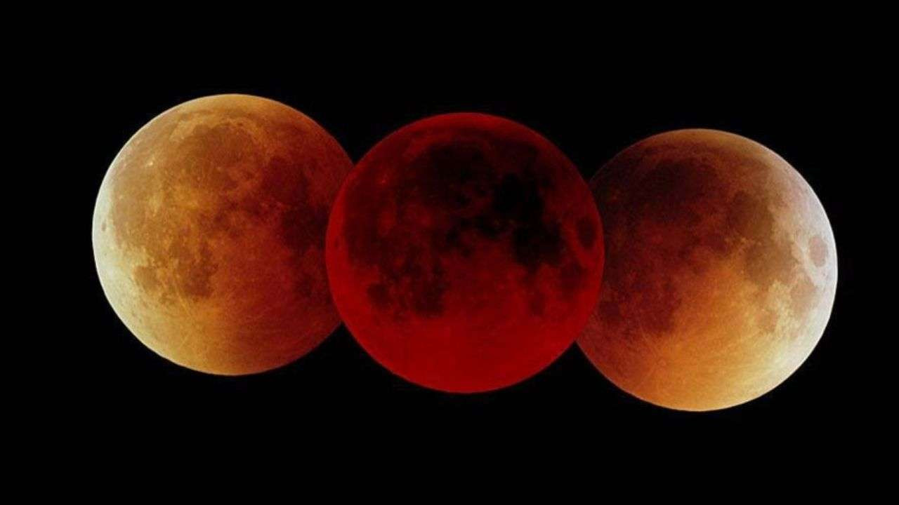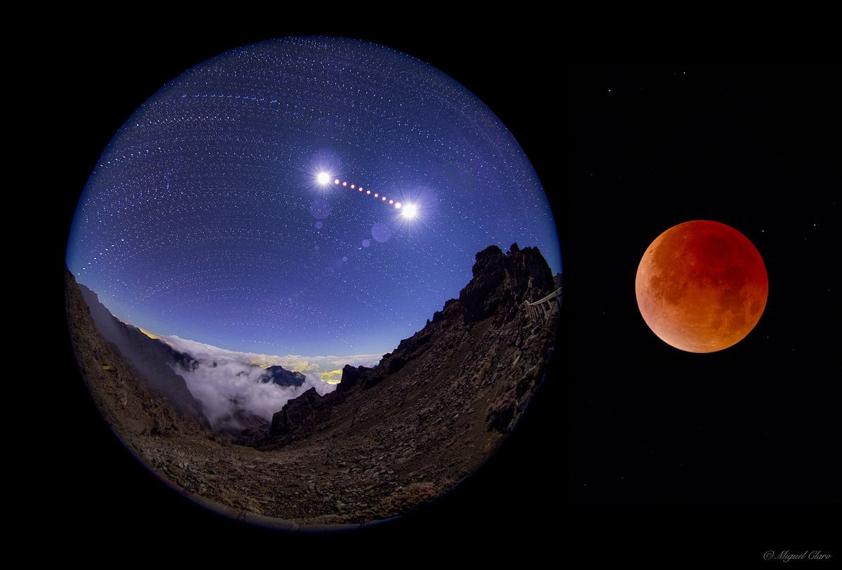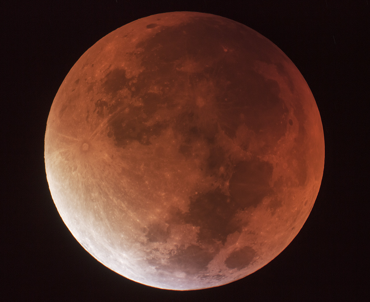
A Super Blood Moon Eclipse is Coming This Week
Get ready to witness a celestial spectacle this Tuesday as a supermoon lunar eclipse paints the sky a vibrant blood red. This rare event coincides with a full moon and a supermoon, making the moon appear larger and brighter than usual. It's an event that will have skywatchers across the globe glued to their telescopes and cameras.
When and How to See the Super Blood Moon Eclipse
The partial lunar eclipse is expected to begin around 8:41 p.m., with the moon turning a reddish hue. This captivating display will continue until 12:47 a.m., as the top edge of the moon becomes obscured at the eclipse peak. The moon will turn blood red, offering a breathtaking sight for those with clear skies.
The Dry and Dusty Climate Impact
The recent weather has been characterized by an unusual dryness. The area has experienced well-below-normal rainfall, with some locations not receiving a drop of rain this month. This dryness is not limited to our region. A massive amount of real estate in the U.S., from the Desert Southwest through the Plains & Midwest to the Mid-Atlantic & coastal Northeast, is incredibly dry for September. Many of these areas have had well-below normal rainfall since early to mid-August, mirroring our own situation.
The dry conditions have been exacerbated by the prevailing east to northeast winds, which have brought in air with dew points in the 30s and 40s, creating a bone dry atmosphere. These conditions have resulted in relative humidities as low as 15% and significantly impacted the soil moisture, making it severely lacking in the 0-40” profile. This severe dryness has prompted a number of counties in Indiana to issue burn bans, including Fountain and Fulton counties in our viewing area.
A Tropical System's Impact
While our area has been grappling with dry conditions, the eastern United States has experienced the impact of a tropical system that, while never officially named, has brought significant rainfall and wind gusts to North Carolina. This system lacked a warm core to be classified as a tropical storm, but it still packed a punch with maximum sustained winds of 40 mph and a gust of 77 mph measured on the North Carolina coast. The system brought flooding rainfall, with some areas experiencing up to 12 inches, and powerful wind gusts along the coast. Though this system is expected to move offshore into the Atlantic in the coming days, it has left its mark on North Carolina, Virginia, and Delmarva.
Looking Ahead: Rainfall Potential and Winter's Fury
The dry weather is expected to persist for the coming days, with the dew points remaining extremely low in the 30s and 40s through Friday. Grass and field fire risk will be quite high. However, a shift in the weather is anticipated for the weekend, with dew points rising into the 40s to 50s on Saturday and 50s to the low 60s on Sunday. By Monday morning-midday, they should reach 65-68.
There is a chance of scattered showers and thunderstorms on Monday as the remnants of Pacific Tropical Storm Illeana and a cold front pivot through the Plains. While the most widespread rainfall is predicted to stay northwest and west of our area towards Iowa and Missouri, there is a 35-45% chance of some coverage here. Later in the month, around September 28, there is potential for a broken line of storms, though the coverage is expected to be better than on Monday, September 24.
As we move towards October, The overall trend points towards a warm surge and continuation of dryness, followed by a potential for solid-soaking rainfall. The latter part of October and into November will likely bring very up and down temperatures, with a substantial warm surge and one or two rounds of severe weather risk in that October 28-November 15 period.
The winter forecast anticipates a wild ride, with lots of wind, an active storm track, above normal precipitation, and above normal snowfall. There will be significant temperature variances of 60 degrees at times over a period of a day or two. The winter will likely end up normal or a bit below normal temperature-wise, despite some big cold surges. But be prepared for Arctic air in late November to early December, late January, and an intense Polar Vortex event in early February. There might even be a minor Polar Vortex event in January.
A Night to Remember
The supermoon lunar eclipse promises to be a spectacle that will have skywatchers enthralled. So, clear your calendars, find a spot with an unobstructed view of the night sky, and prepare to be amazed by this celestial wonder. The blood red moon, a supermoon, and a lunar eclipse all in one night—it's a celestial event you won't want to miss.