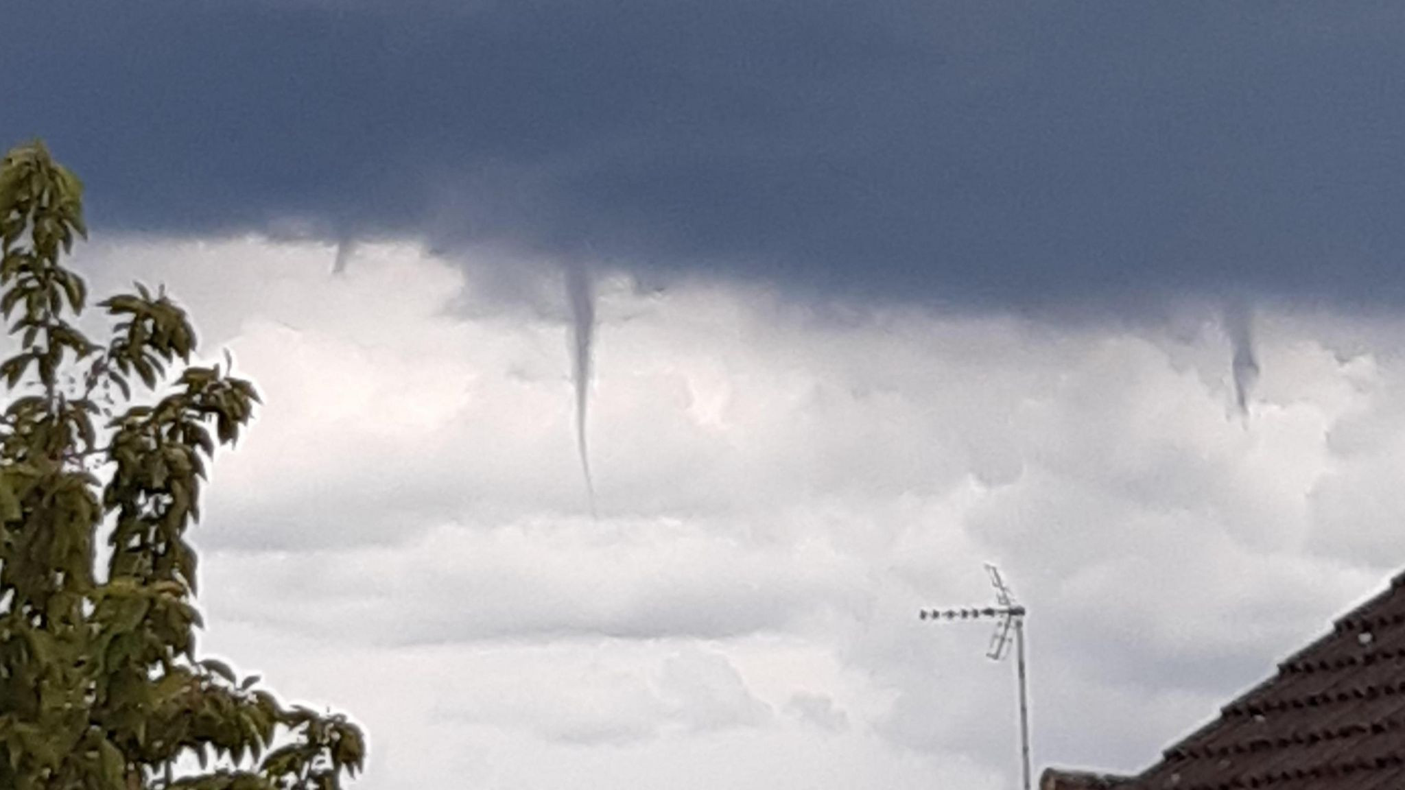
Residents spotted quite the sight in the skies over Brantford, Ontario, on Saturday afternoon as a thick funnel cloud spun over the community during a thunderstorm. The funnel-spawning thunderstorm moved over Brantford around 5:45 p.m. local time, one in a group of heavy storms that pushed across southwestern Ontario through the afternoon hours.
Scattered thunderstorms spread over southern Ontario on Saturday as a disturbance swung through the region. This is the first measurable rain many communities in the area have seen in more than a week—putting an end to the region’s longest dry streak of 2024.
A funnel cloud is a rotating column of air that extends beneath the base of a shower or thunderstorm, but doesn’t come in contact with the ground. Funnel clouds can develop from the base of rapidly growing thunderstorms like the ones we saw on Saturday.
Take a look at some of the views residents around Brantford saw during Saturday’s storm, below.
Photos and video taken in Brantford of the funnel cloud that occured approximately 540pm. Taken from King George road facing NW #theweathernetwork #onwx pic.twitter.com/zBwTk7ibEI
— Cameron (@Cameron_wx) September 21, 2024
Seen my first funnel cloud @weathernetwork #onstorm #brantford #ON pic.twitter.com/HsECAulFH9
— christina willson (@krystynawillson) September 21, 2024
Brantford, Ontario Bisset avenue #weathernetwork pic.twitter.com/vxDsDUhGhz
— Cathy Rodgers (@cath8588) September 21, 2024
A woman in Brantford, Ontario, was amazed as a thick funnel cloud loomed over the area during a thunderstorm on September 21. This footage, captured by @MissFit_Jen from Brantford, shows the funnel cloud. “What a sight from my backyard,” @MissFit_Jen captioned the video. Credit: @MissFit_Jen via Storyful
Funnel Cloud Formation and Weather Systems
The formation of a funnel cloud is a fascinating meteorological phenomenon. It typically occurs when a thunderstorm is in its early stages of development. The rising air within the storm creates a powerful updraft, causing the air to rotate. This rotation is what forms the funnel shape that we see in the sky.
The thunderstorm that spawned the funnel cloud over Brantford was part of a larger weather system that moved across southern Ontario. The weather system brought scattered thunderstorms and heavy rainfall to the region, providing relief from the recent dry spell.
Importance of Weather Awareness
The appearance of a funnel cloud, even if it doesn’t touch the ground, is a reminder of the powerful forces at play within the atmosphere. It’s important for residents to be aware of weather warnings and to take appropriate precautions during thunderstorms. While funnel clouds are generally not as dangerous as tornadoes, they can still pose a threat to property and personal safety.
Conclusion: A Rare Sight in the Sky
The funnel cloud sighted over Brantford was a rare and awe-inspiring event that captivated residents. It serves as a reminder of the ever-changing nature of weather patterns and the importance of staying informed about weather conditions. While the sight may have been breathtaking, it’s crucial to remember the potential dangers associated with such meteorological phenomena and to prioritize safety during severe weather events.


