Stay alert for rapidly changing conditions through the day across southern and eastern Quebec.
Hot, humid air parked over Quebec will fuel a round of thunderstorms across parts of the province on Saturday as a cold front tracks into the region.
DON’T MISS: Tropical storm warnings issued as growing system nears Florida
It’s a classic midsummer setup across Quebec as a spell of hot and humid air remains locked in place over the province through the weekend. Humidex values will near 40 from Montreal all the way north into Quebec City.
Quebec Weather Forecast for the Weekend
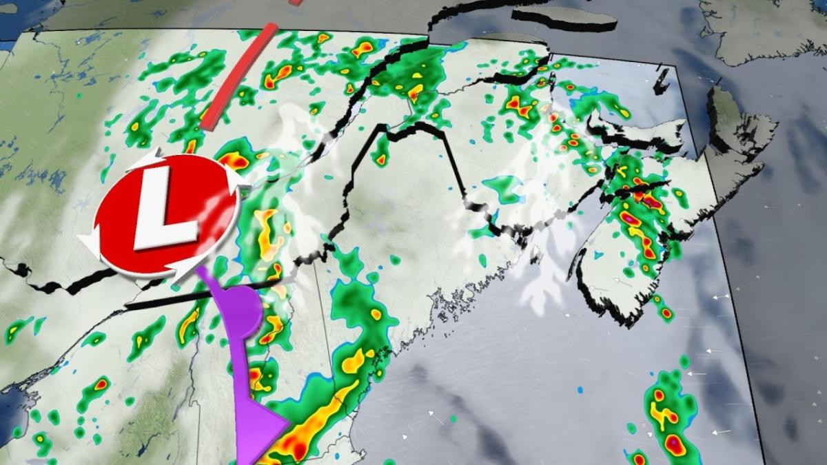
A cold front tracking through the province on Saturday will serve as the trigger to fire up thunderstorms that will easily thrive on the muggy airmass. These storms will likely begin west of Saguenay through the late afternoon hours, pushing south and east through the evening.
MUST SEE: If you're camping, make sure you have a plan for severe weather
Saguenay and Quebec City should remain on the lookout for storms arriving around dinnertime on Saturday.
There is a small possibility that severe storms around Trois-Rivieres and Quebec City could have rotation, making the tornadic threat non-zero on Saturday.
These storms could turn severe with strong wind gusts, small hail, and heavy rainfall. Wind gusts of 100+ km/h are possible if these storms form into a squall line. Make sure you stay close to safe shelter if you plan on being out Saturday evening.
Thunderstorms will push south and east as the evening progresses, potentially remaining severe as they cross the Gaspé Peninsula and portions of the Eastern Townships.
Forecasters expect a chance for nocturnal thunderstorms to reach Metro Montreal before midnight, though these storms should remain below severe limits.
Quebec Weather Forecast for Wednesday
Wednesday will be a day to keep an eye on the skies, as severe thunderstorms with periods of heavy rain take aim at parts of Quebec.
Two systems will converge over the province, increasing the storm potential throughout the day. Widespread periods of heavy rain and strong wind gusts are expected, with severe conditions likely, especially along the St. Lawrence and the Eastern Townships.
It'll be important to stay up-to-date on the alerts in your area, as conditions can change quickly when severe weather hits.
MUST SEE: Toronto officially records its rainiest month ever
These convective storms threaten to produce torrential rain as they pass through the province on Wednesday. Heavy rain will be the main threat due to the high humidity content in the atmosphere.
Several storms could occur in the same region, and therefore threaten to dump significant accumulations throughout the day. The corridor most at risk extends from the extreme south of the province through central Quebec to Saguenay.
Temperatures will not reach record highs on Wednesday, but the air will be very humid, helping to create a lot of moisture in the atmosphere.
By 9 a.m. Wednesday morning, some significant accumulations had already been reported, with the city of Trois-Rivières picking up 36 mm, including 15 mm from just 8-9 a.m.
Click here to view the video
Be sure to check back for the latest weather updates across Quebec.
With files from MétéoMédia
A Busy Week for Weather
While Quebec grapples with thunderstorms, other parts of Canada are dealing with their own weather challenges. In British Columbia, a massive landslide has dammed the Chilcotin River, creating a lake that could burst and send a surge of water down the Fraser River.
In the meantime, scientists are concerned about a record-breaking heat wave in Antarctica, which could have significant consequences for the health of the continent and the global climate.
Stay tuned for more updates on these stories and other weather events around the world.